In version 2.3.0 the next items are added or changed:
The close buttons on both map types are now made with embedded buttons.
The download kml-file has been removed from the Google Earth web page.
All jAlbum skins do use now the same template file, the skin res directory is no longer used.
The MakeMap program can now also be used for the jAlbum Plain skin, see this Plain sample album, more info in this note.
If the new check-box Enable links has been cleared, no light-box with the corresponding slide page will be opened if you click on a way-point in the map and next in the thumbnail.
In version 2.4.0 the next feature has been added
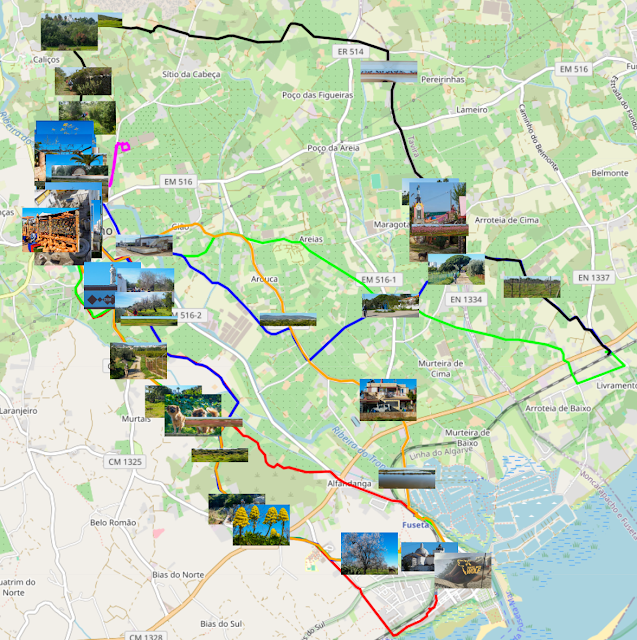
It is now possible to display up to 8 tracks in an OpenStreetMap in different colors:
The following 8 file-names can be used to display tracks in OpenStreetMaps:
- track.js, the default value in program ConvertTrack, wil show a red track.
- trackGreen.js which will display a green track.
- trackMagenta.js which will display a magenta track.
- trackBlue.js which will display a blue track.
- trackBlack.js which will display a black track.
- trackBrown.js which will display a brown track.
- trackYellow.js which will display a yellow track.
- trackOrange.js which will display a orange track.
In version 2.5.0 the next features have been added
- The new Plain and Lizard skins are now supported, see this Plain album and this Lizard album.
- It is now possible to use thumbnail images instead of fixed marker icons:
see also the maps of this album. - An OpenStreetView map is now centered around a selectable waypoint
- The zoom level of an OpenStreetView map is lowered for smaller devices.
In version 2.8.0 the next item is changed:
In version 2.9.0 the next items are changed:
All track js-files starting with the tekst 'track' are now automatically displayed in an OpenStreetMap made with program MakeMap.
The used track js-files should now contain the track color, program ConvertTrack version 2.1 adds the selected track color to the js-file. Track js-files made with earlier versions can no longer be used, so the corresponding gpx files should again be converted by the newest ConvertTrack program.
If the selected album did contain just one slide with a GPS location, there was a problem which has been repaired in this version.


Geen opmerkingen:
Een reactie posten